Killearn
Killearn is evidently compounded of the three Celtic words, Kill, ear and rhin, signifying cell, or church of the west point. Such an etymology, at all events, is descriptive of its situation; while, with consent of the patron, it was erected into a prebend in the cathedral church in 1429, by John Cameron, bishop of Glasgow.
Killearn stands below Fintry on the south side of the river. It is bounded by the Endrick, which seperates it from Balfron on the north and from Drymen on the west. The parish is six and a half miles long from east to west, and seven miles long from north to south, although because of its irregular shape it is only three and a half miles broad at its widest part and one mile at its narrowest point. The Blane flows through a portion of the western part of the parish and falls into the Endrick. There is rich alluvial soil along the banks of the rivers, above that the land is dry field, and above the line of cultivation it is rough hill pasture and heather.The rocks of the valley are old red sandstone which were at one time quarried, and there is a stratum of millstone grit between Balglass and Ballikinrain, from which in previous times millstones were cut. The area is no longer used for that purpose. The highest of the Campsie Hills, Earl‘s Seat, stands 1894 feet above sea level, and is situated at the point where the parishes of Strathblane, Campsie, Killearn, and Fintry meet. the next most prominent hills in the parish are Clachertyfarlie Knowes, 1781 feet, and Auchinden Hill, 1158 feet.
Both parish and neighbourhood were, for a considerable time, unhappily exposed to the plundering inroads of large companies of migratory freebooters, who for safety lurked in the borders of the Highlands. These depredators made frequent incursions into the parishes of Buchanan, Balfron, Killearn, Dumbarton etc. and carried off all the cattle they could find. This infamous practice was continued so late as the year 1743. Long before that, however, some gentlemen near the borders of the Highlands, undertook, for certain sums of money, to protect the property of their neighbours, and to make a full recompense for what was stolen from them. The money paid for this protection was called blackmail, and was paid agreeably to a bargain concluded upon by the two contracting parties.
The old church and burial-ground have, lately, been greatly improved by the heritors. A recess, or side-room, that had been erected by one of their number, for his own accommodation and comfort, and which was out of harmony with the original building, has been removed; while a number of decayed trees, several of which had fallen and broken the church-yard wall, have also been cut down, and the roots of the few which remained comparatively fresh lifted – being so long that it was scarcely possible to open graves in their immediate vacinity.
Apart from its surroundings, there is little connected with Strathblane of special interest.
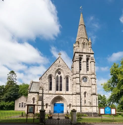
The hills here rest upon a sandstone running west towards Benlomond, and are capped with masses of trap. Their highest point bears the name of “The Earl’s Seat”, which is 1,400 feet above the level of the sea. Scotch firs, and larch, Huntingdon willows, black poplars, and gnarled oaks are the trees common throughout the district. On the pavement of the parish church a monumental slab is thus inscribed:
”Here lyes in the same grave with Mary, Countess of Angus, sister of King James I. of Scotland, from whom he is lineally descended, Archibald Edmonstone, Esq. of Duntreath, in this kingdom, and of Redhall, Ireland, who died in the year 1689, aged about 61 years”.
Mary Stuart, daughter of Robert III., was thrice married. Her third husband was Sir William Edmonstone of Duntreath, in whose burial-place she was interred. The grave was opened about forty years ago, when the skull of the deceased princess was found entire. She was mother of James Kennedy, and of Patrick Graham, who were successively bishops of St. Andrews.
On the southern side of the valley, eastwards, rises the wooded cliff where Lennox castle is perched. It nestles there as snug and strikingly defensive as castle could do, embowered among hardy trees. The house, which is in the boldest style of the old Norman architecture, from a design by the late David Hamilton of Glasgow, was commenced in 1837, and finished in 1841.
A short distance from the boundary of Fintry and Killearn parishes are the remains of the old castle of Balglass, which was formerly well fortified, and once offered protection to Sir William Wallace. Other properties which were of some note in the area are Ballikinrain, once owned by the Napiers; Boquhan, for many years the home of a family of Buchanan; Parkhall, formerly the property of Sir Michael Connal. Near Parkhall the road branches off to Balfron, passing the property of Boquhan and crosses the Endrick by a stone bridge. The pipes that lead the water from Loch Katrine to Glasgow cross the road near this, and a road goes north at this point leading to Aberfoyle.
The village of Killearn stands nearly 300 feet above sea level and from there one can view the magnificent spread of the lower part of Strathendrick and Loch Lomond. George Buchanan, historian, poet, statesman, and tutor to James VI., was born at Moss, on the river Blane in this parish, about two miles south of the village, and there is a monument to his memory in the village. His father Thomas was of the family of Drummakill, and his mother Agnes Heriot, of Heriot of Trabourn, was gt. aunt to James Heriot, jeweller, who left funds for the establishment of the now well known Heriot School in Edinburgh.
Adjoining the village is the estate of Carbeth, and on the farm of Blairessan which lies within the estate of Carbeth tradition has it that a battle was fought between the Romans and the Caledonians near the Spout of Blairessan.
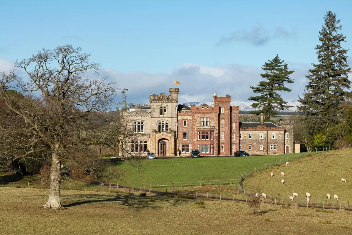
Carbeth House, on the Killearn Heritage Trail
About a mile north of Killearn standing above the river Endrick is the house of Carbeth. It belonged to a branch of the Clan Buchanan and was sold in 1873 to a Mr. Forrester, and afterwards to a Mr. Wilson. Killearn House stands on the left of the bank of the Blane about a mile and a half west of Killearn. It was formerly the seat of a cadet of Montrose. In 1750 it was sold to a Mr. Scott of Glasgow, whose only daughter married Sir James Montgomery at one time Lord Chief Baron of Scotland. The Carnock Burn joins the Blane a short distance to the north of the house. It forms a quite remarkable glen – Ashdow Glen, from the Gaelic usage dubh, black water. The burn runs perpendicularly through the red sandstone to a depth of about 70 feet, and in some places the chasm is not more than 15 to 20 feet in width from top to bottom. The Blane falls into the Endrick half a mile below this point, and about three quarters of a mile above where the Blane joins the Endrick is the Pot of Gartness, where the Endrick falls over a rock face that stretches across the river. The fall is not high and salmon and trout are seen forcing their way up river.The road here leads to Gartness Station on the Forth and Clyde Railway, and crosses the river by a bridge a short distance higher up, where at one time stood a woollen mill, and a small hamlet, on the Drymen side of the river.
Opposite the fall on the Drymen side stood an old corn mill, and close adjoining it is the house of Gartness, where John Napier of Merchiston resided during a considerable part of the time when he worked out his system of Logarithms. Robert Buchanan of Drummakill who died in 1525 married Catherine Napier, daughter of Archibald Napier of Merchiston. Catherine was gt. aunt to John Napier of Merchiston.
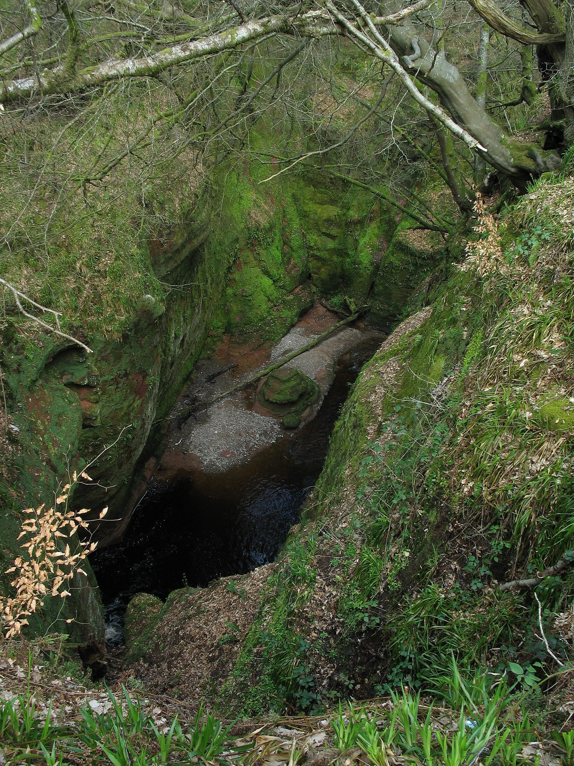
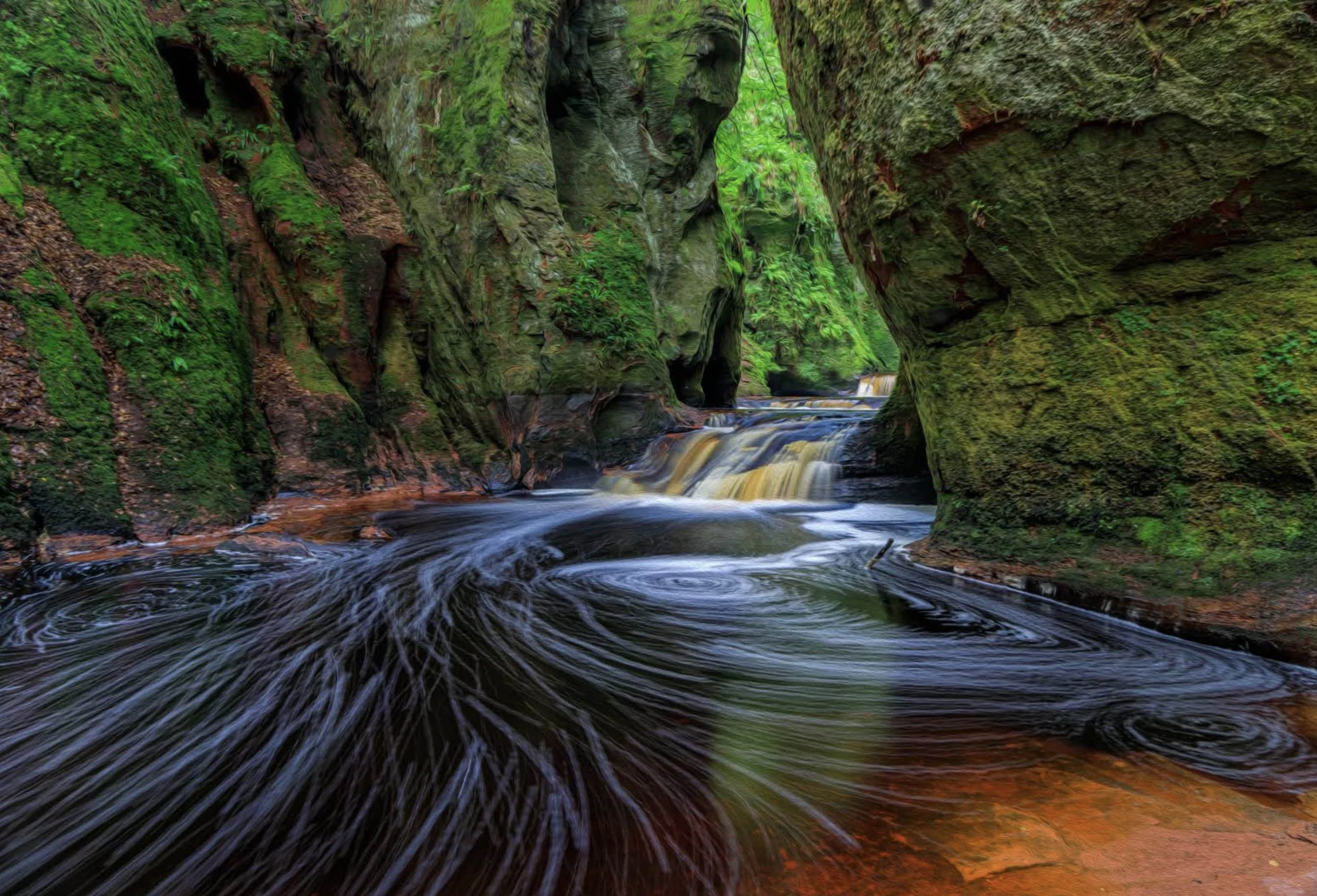
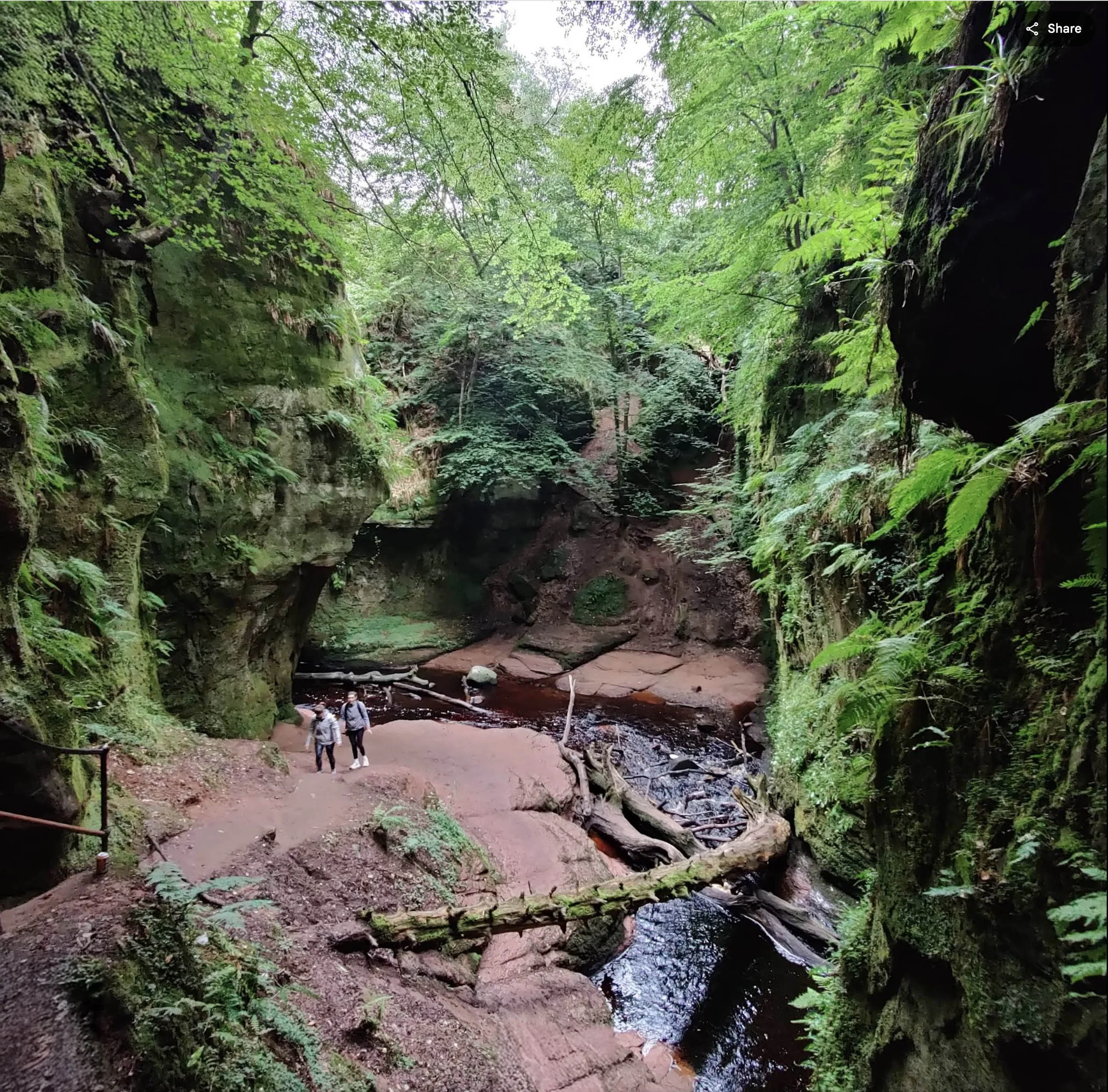
West of Killearn and South of Drymen is a george called Finnich Glen, and within that is The Devil’s Pulpit.
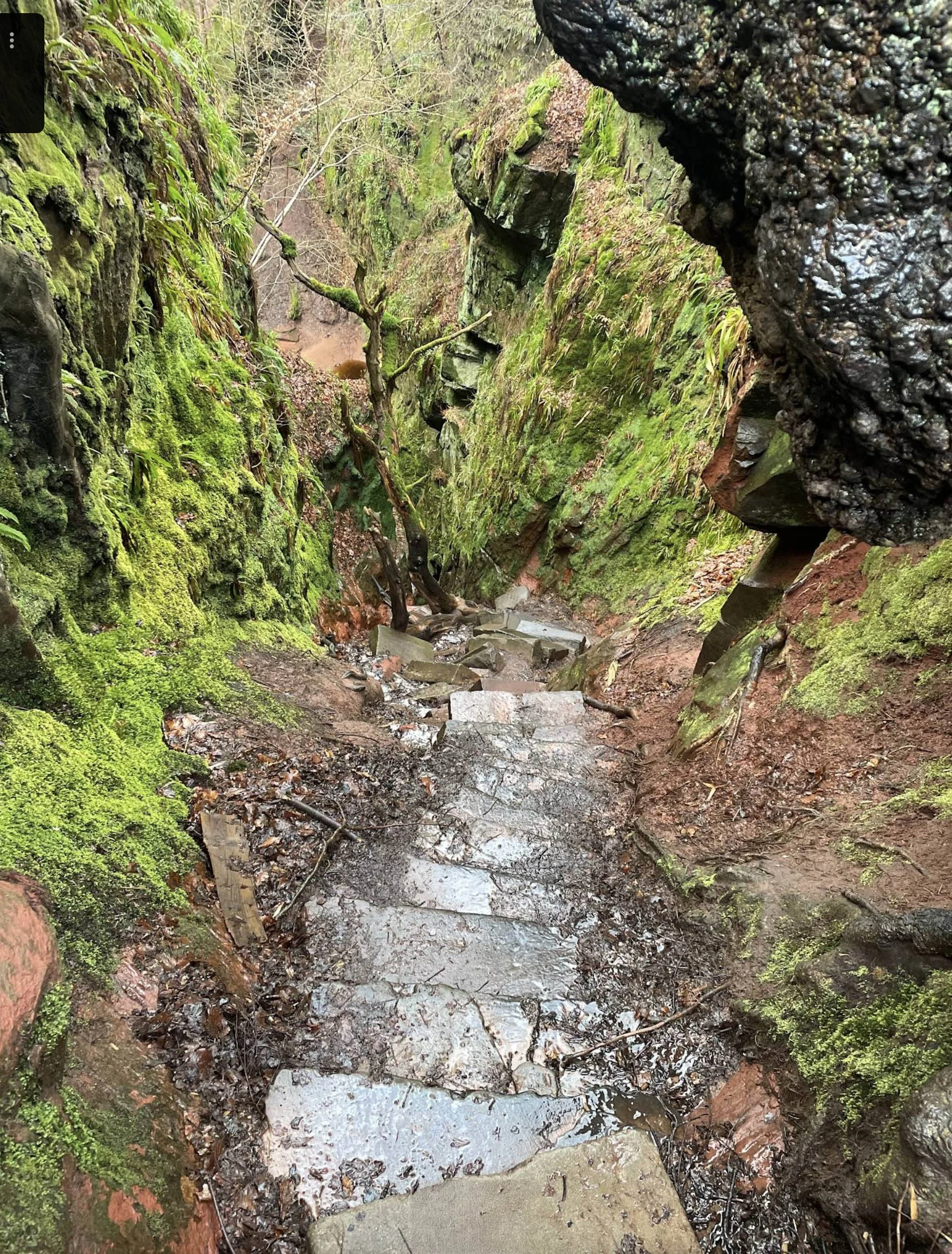
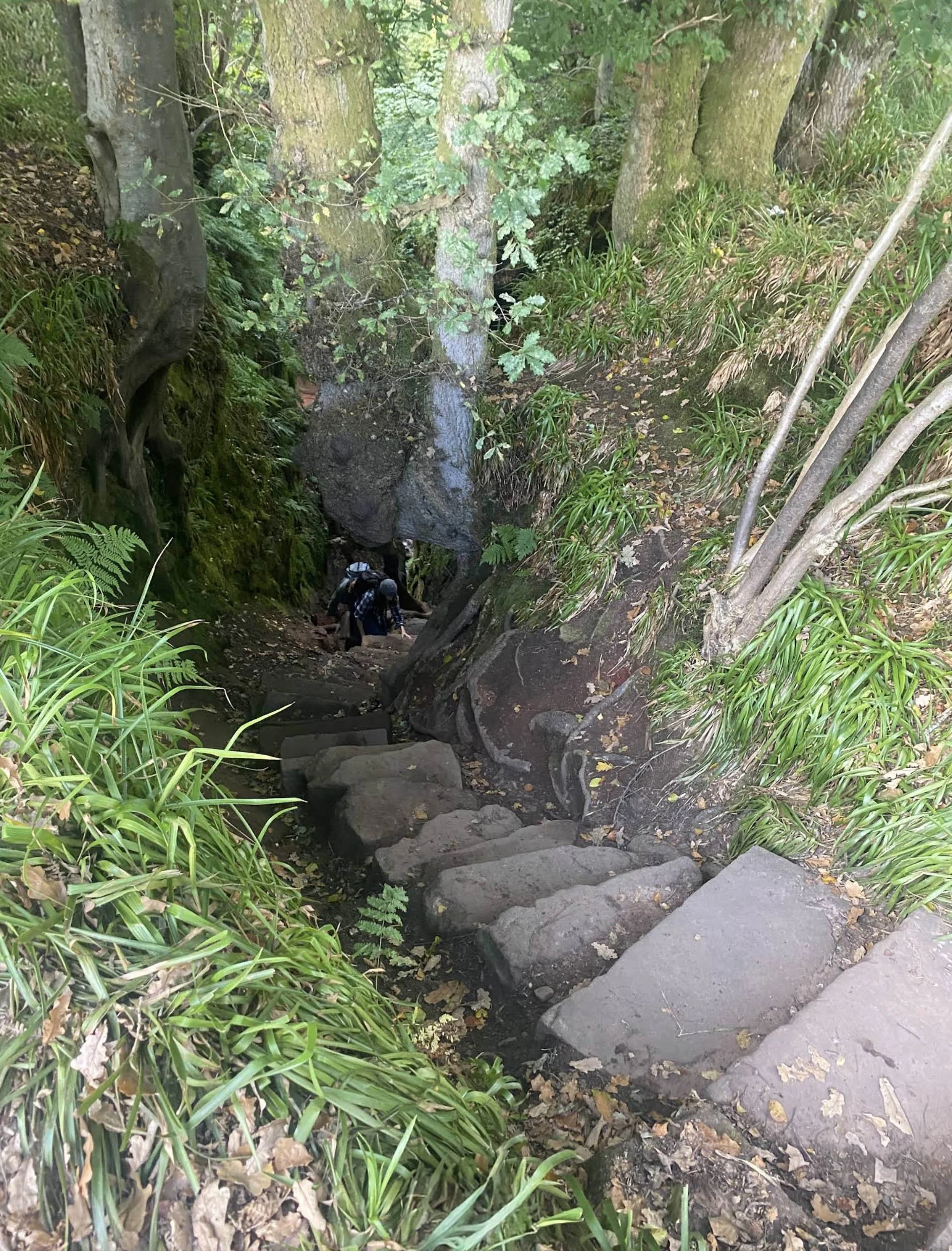
This glen is up to 70 ft deep which runs east from Finnich Bridge on the A809. Parking is “on site” only, signage is sparce, and it feels like it is suffering from over-tourism. The george was carved in the red sandstone by the Carnock Burn. Down a steep staircase known as the Devil's Steps (built around 1860) is the circular rock known as the Devil's Pulpit.
The water runs red, but don’t worry, it’s not the water itself but the red sandstone it flows over.
Best seen when the water is low, this rock is said to be where the devil would stand and address his followers as the red waters swirled under his feet. Other say that Druids would come here to preach and make merry, perhaps guided by the evil forces of nature.
This site was used in the TV series Outlander in 2014 to depict the fictional St Ninian's Spring.